// Lab 308 Technology
Aerial fire
imaging technology.
Clear imagery. Precise geolocation. Intelligence that fits the way you already fly.
Explore cameras// Engineered for the real world
We turn aerial imagery into usable fire intelligence—from a pilot's live view to a shared incident map.
// Technology / 01
Clear HD imagery
See the heat. Understand the incident.
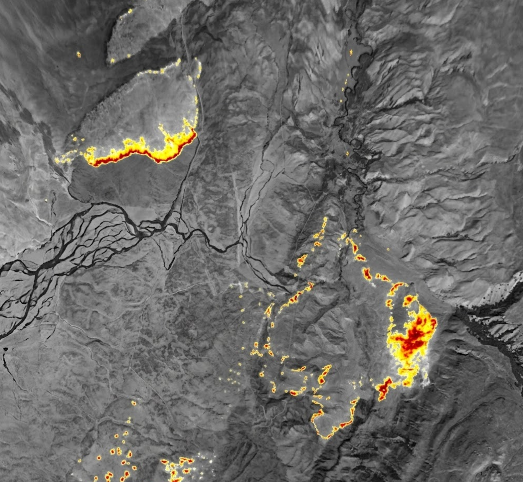
Advanced infrared cores reveal thermal detail through smoke, haze and darkness. Live video brings situational awareness to the cockpit, while radiometric sensors on supported models add temperature information to geolocated snapshots.
LWIR thermal video · Hotspot detection · Radiometric snapshots on supported models
// Technology / 02
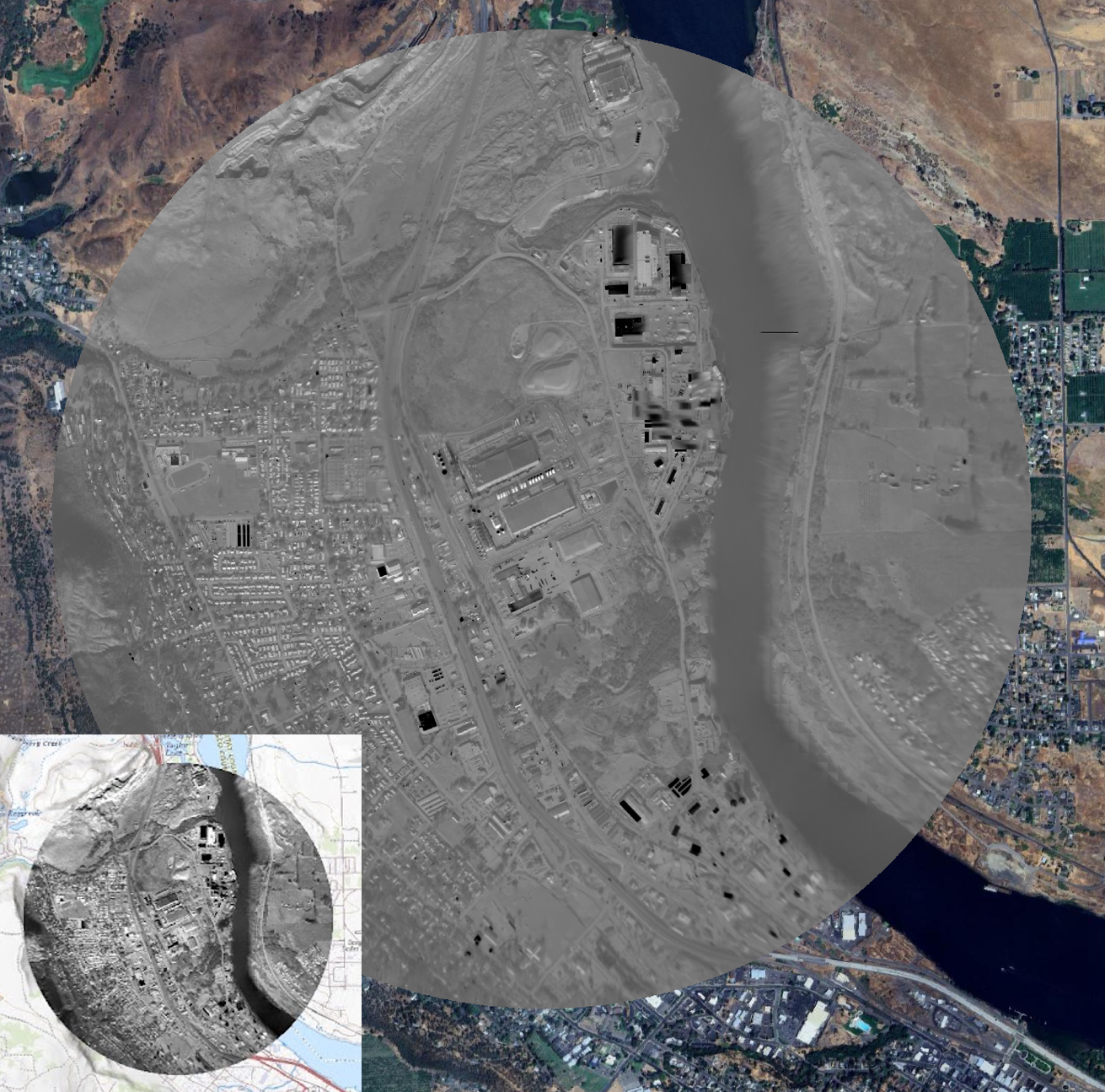
Always geolocated
Not just an image. A location you can act on.
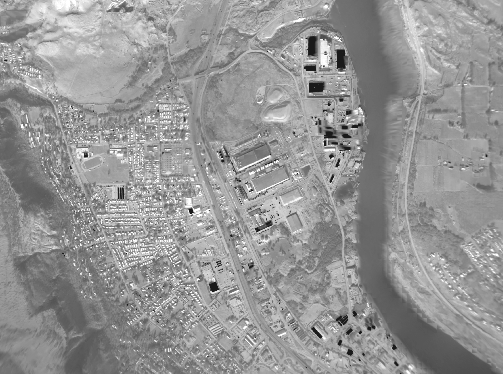
Lab 308 combines inertial sensing, GPS data and image-aided processing to locate imagery in the real world. Depending on the camera, GPS comes from an onboard receiver or an external digital input. Systems self-calibrate in flight using image aiding, without GPS lever-arm measurements.
Image-aided geolocation · In-flight calibration · GIS-ready snapshots
// Technology / 03
No operational changes
Fly the mission. Let the cameras do the mapping.
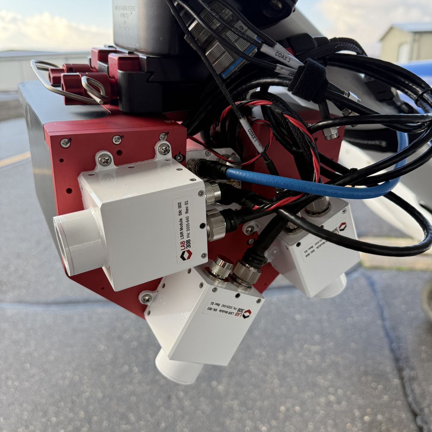
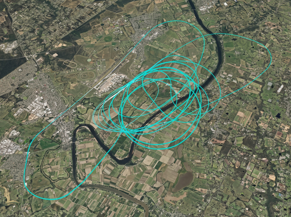
Fixed, wide-field-of-view cameras passively collect imagery when aircraft conditions permit. There are no special mapping flight paths or dedicated camera-operator tasks. Compact, aviation-ready systems integrate onto existing aerial fire platforms and work in the background.
Passive collection · Orbit-friendly coverage · No dedicated operator
// From aircraft to incident command
One stream. Shared intelligence.
Capture
Fixed aviation cameras collect video and still imagery with embedded geolocation.
Uplink
Starlink, SATCOM or cellular connectivity sends image streams to your cloud provider.
Process
Open-source geospatial tools stitch imagery into orthorectified maps without human involvement.
Deliver
Fire maps, perimeters, hotspots and streaming video reach GIS and common operating picture software.
Direct viewing does not require an ongoing software license. Cloud processing requires connectivity; cloud providers and GIS software may incur usage charges.
// Multispectral mapping
More layers. More context.
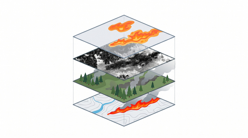
AiO brings three LWIR cameras together with RGB and near-infrared sensors. Heat, visible terrain and burned-area imagery combine to support mapping before, during and after a wildfire.
LWIR
Heat layer
RGB
Visible context
NIR
Burned area
// Our story
Built in Oregon. Built for the mission.
Founded in Hood River, Oregon by two technology entrepreneurs, Lab 308 is a team of engineers and problem-solvers focused on smarter aerial firefighting.
We bring imaging, sensing and computing together in compact, field-ready systems. Our aim is practical: give firefighters real-time intelligence that helps them make faster, better-informed decisions.