
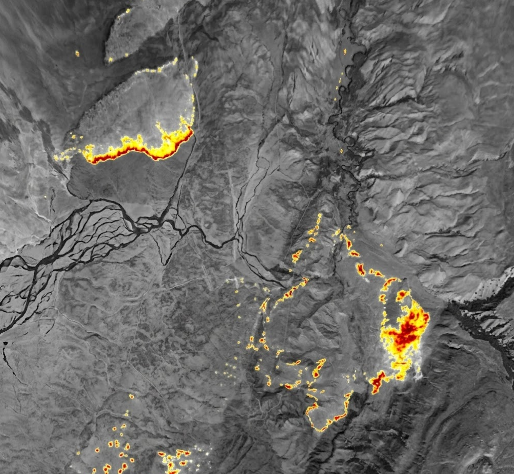
// 3 IR / 1 RGB · Coming in 2027
miniARINC Mapper
Small footprint. Wide-area intelligence.
Three LWIR sensors and RGB imaging in a GPS-antenna-sized aviation system. Orbit-friendly passive fire mapping without special flight paths.
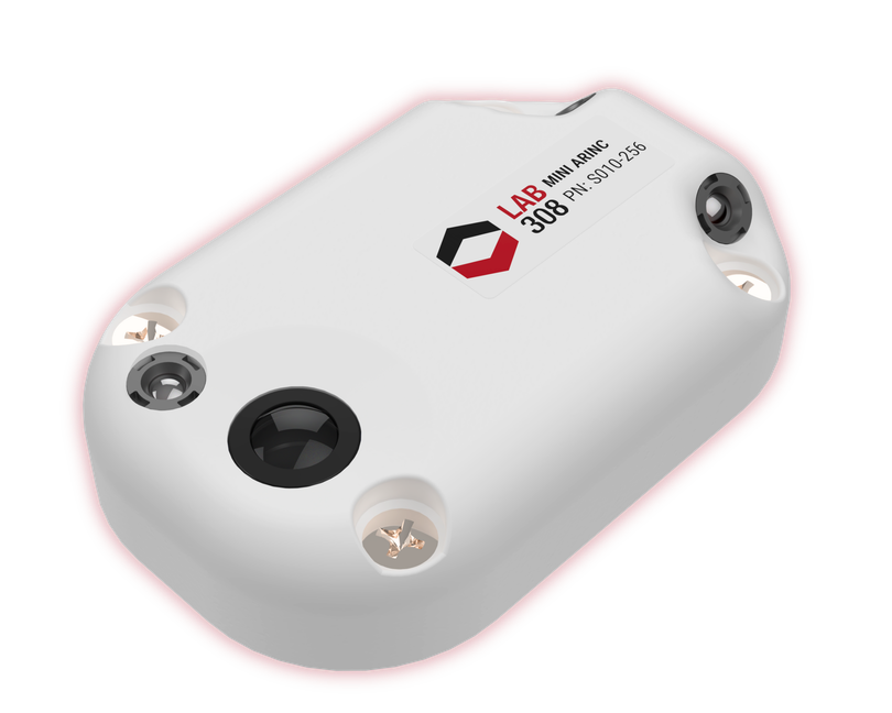
// miniARINC Mapper · Preliminary
A compact system. A complete view.
A combined 150° horizontal field of view brings three LWIR sensors and a 3.2 MP RGB sensor together for aerial fire intelligence. Integrated GPS/INS, onboard multi-day storage and native cloud offload connect imagery to geolocated maps in a housing designed for the Mini-ARINC hole pattern.
Price TBD/Coming in 2027
// Capabilities
Intelligence in the air. Less hardware.
Thermal + RGB coverage
Three LWIR sensors capture thermal imagery alongside a 3.2 MP RGB sensor, across a combined 150° horizontal field of view.
Geolocated video and snapshots
Integrated GPS/INS supports H.264 video with MISB KLV metadata and full-resolution georeferenced stills with infrared temperature information.
Orbit-friendly passive mapping
Collect aerial fire imagery without special flight paths. Onboard storage and native cloud offload connect collection to shared maps and streaming video.
// Specifications / miniARINC Mapper
Small by design. Wide by nature.
- IR sensors
- 3 × LWIR
- RGB sensor
- 3.2 MP
- Radiometric accuracy
- ±10°C at operating altitude
- GSD at 2,500 ft
- IR 2.8 m / RGB 0.95 m
- Combined horizontal field of view
- 150°
- Dimensions (L × W × H)
- 3.4 × 2.2 × 0.75 in
- Weight
- <150 g
- Power
- 15 W · 12–28 V DC
- Connection
- 100 Mbps Ethernet
- Positioning
- Integrated GPS/INS · L1 multi-constellation GPS or digital input
- Mounting
- Mini-ARINC hole pattern
- Storage
- Onboard multi-day storage
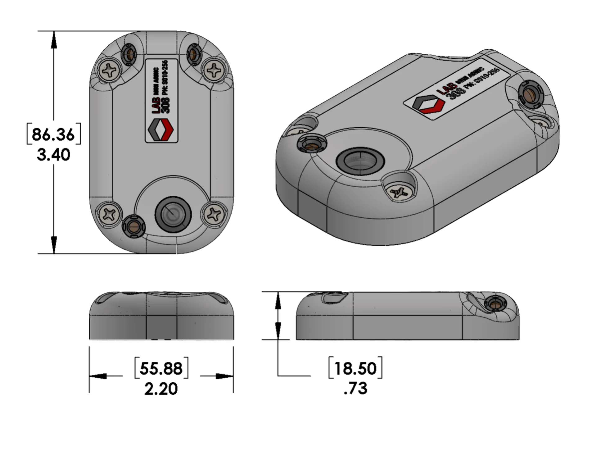
Preliminary specifications — subject to change. October 2026.
// Purchase & seasonal leases
Plan your configuration.
| Configuration | Size (L × W × H) | Weight | Purchase | 3-month lease | 6-month lease |
|---|---|---|---|---|---|
| miniARINC Mapper · 3 IR / 1 RGB | 3.4 × 2.2 × 0.75 in | <150 g | Price TBD | Not announced | Not announced |
Coming in 2027. Purchase pricing is TBD; seasonal lease pricing and terms have not been announced. Contact us for customized variants. Preliminary specifications are subject to change.
Discuss your configuration// Hardware outputs
Ready to connect.
- H.264 MISB KLV digital video
MISB ST 0601 metadata over Ethernet · approximately 1 Mbps video stream
- Full-resolution geo-snapshots with IR temperature
Georeferenced stills for GIS applications
- Thermal and color imagery
Three LWIR sensors and one RGB sensor in a compact mapping system
// Software / Cloud outputs
Ready to share.
- Orthorectified image mosaics with IR hotspots
- Active-fire perimeters in .SHP and .KML formats
- Full- and low-resolution geo-snapshots
- H.264 streaming video
- Cloud-hosting provider independence
No ongoing software license is required for direct viewing. Cloud processing and sharing depend on connectivity and the selected platform. Cloud providers and GIS software may incur usage charges.
// Product documentation
miniARINC Mapper datasheet
Original preliminary specifications, configuration and outputs · PDF · 2 pages