
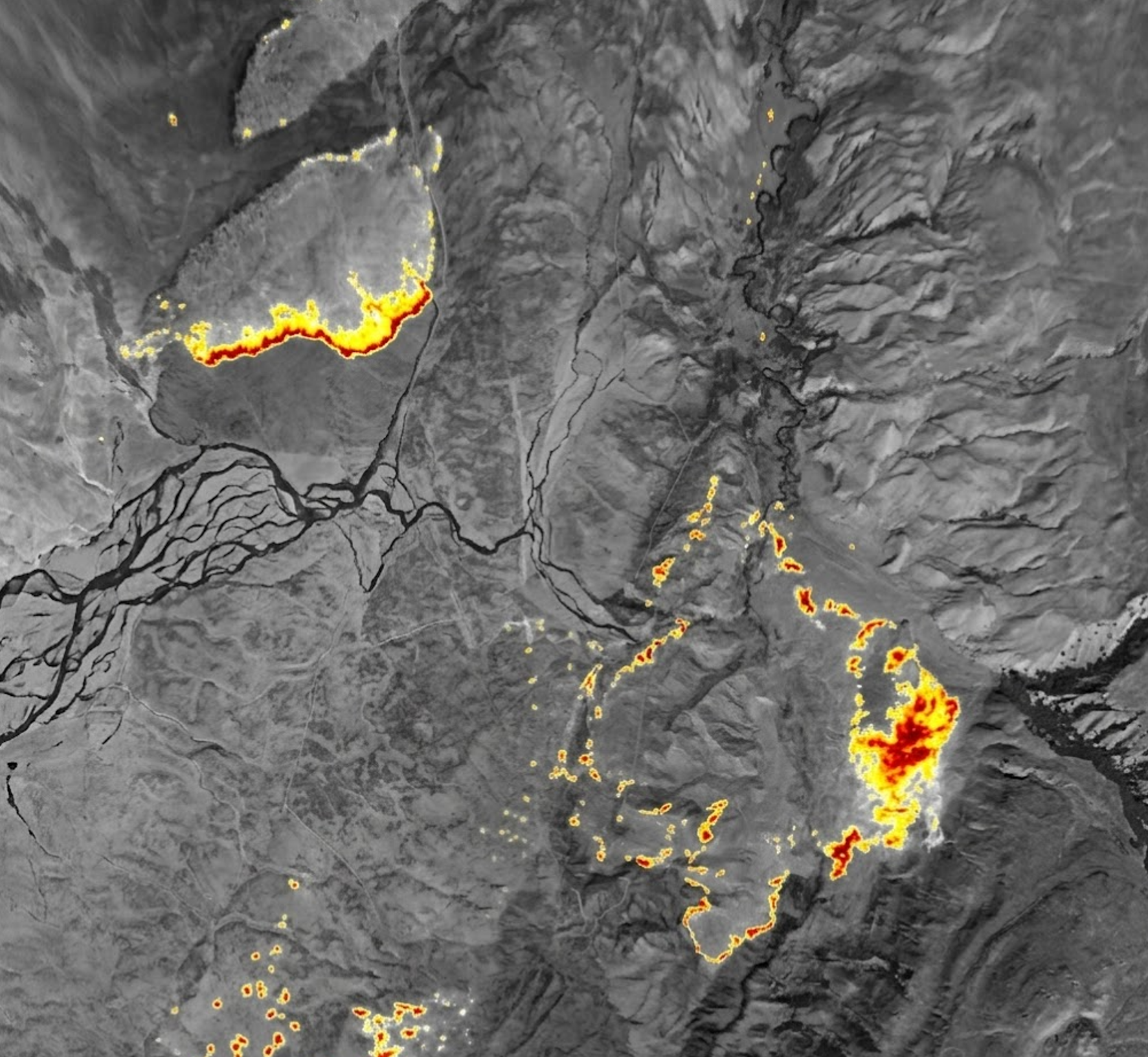
// SD IR / HD IR · Modular Mapping
LSIR
Modular cameras. Mission-wide intelligence.
Zero-operator infrared mapping. Distributed modules work together to deliver a live view of the fire from above.
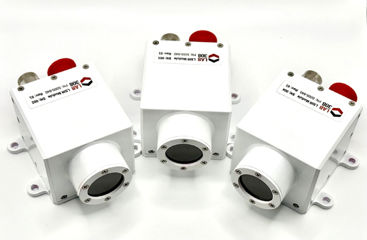
// LSIR · Radiometric LWIR
A modular approach to fire mapping.
LSIR brings radiometric thermal imaging to a distributed camera system. Choose SD or HD modules for your aircraft, with geolocated images and video connecting the aerial view to incident intelligence.
As low as $17,900 SD / $28,200 HD/Lease available
// Capabilities
Intelligence in the air. And beyond.
Distributed thermal modules
A modular system of infrared cameras working together for aerial fire mapping, with SD and HD options to suit the mission.
Geolocated imagery
Position-tagged thermal images and video connect what the camera sees to where it is happening on the ground.
Zero-operator mapping
Passive infrared mapping delivers a view of the incident without a dedicated camera operator.
// Specifications / SD & HD configurations
Small footprint. Serious capability.
- Configurations
- SD / HD
- Weight
- 300 g SD / 350 g HD
- LWIR GSD at 2,500 ft
- 1.3 m SD / 0.65 m HD
- Field of view
- 60° HFOV
- Radiometric LWIR
- Yes
- Geolocated images
- Yes
- Geolocated video
- Yes
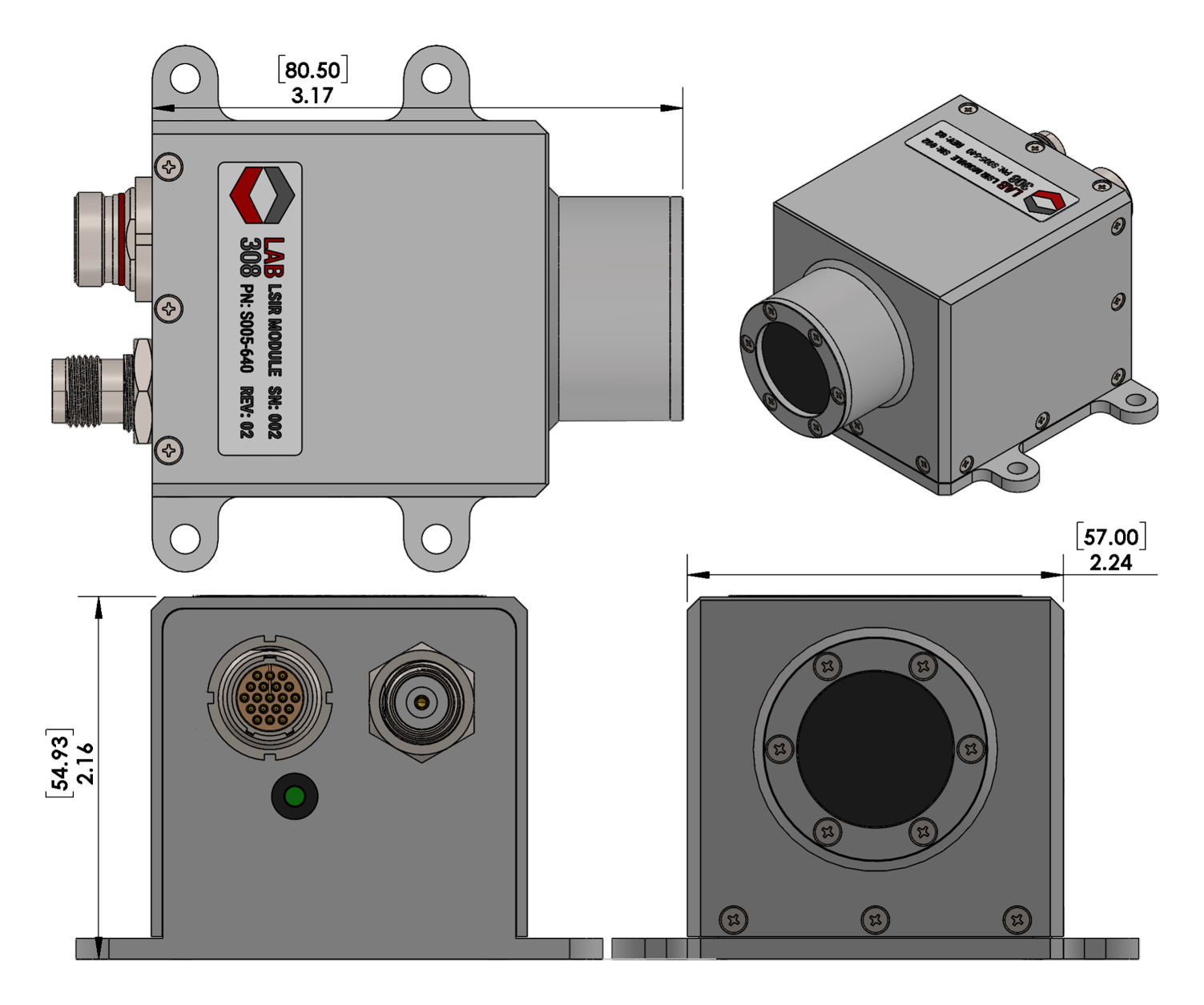
Specifications from the LSIR product datasheet. Preliminary specifications — subject to change. October 2026.
// Purchase & seasonal leases
Choose your configuration.
| Configuration | Weight | LWIR GSD at 2,500 ft | Purchase from | 3-month lease | 6-month lease |
|---|---|---|---|---|---|
| SD · 60° HFOV | 300 g | 1.3 m | $17,900 | Request quote | Request quote |
| HD · 60° HFOV | 350 g | 0.65 m | $28,200 | Request quote | Request quote |
Prices shown are starting prices. Contact us for aircraft-specific configurations and seasonal lease pricing. Specifications and pricing are subject to change.
Request lease pricing// Hardware outputs
Ready to connect.
- Radiometric thermal imagery
LWIR imagery in SD or HD configurations for aerial fire observation
- Geolocated images
Thermal stills tagged with their position on the ground
- Geolocated video
Position-tagged thermal video from the modular camera system
Contact Lab 308 to confirm hardware interfaces and integration requirements for your selected LSIR configuration.
// Software / Cloud outputs
Ready to share.
- Passive infrared imagery for fire mapping
- Geolocated thermal images for compatible mapping applications
- Geolocated video for incident awareness
- Mapping and sharing through compatible processing platforms
Mapping products and cloud sharing depend on the selected system configuration, processing platform and connectivity. Cloud providers and GIS software may incur usage charges.
// Product documentation
LSIR datasheet
LSIR SD and HD specifications, configurations and outputs · PDF · 2 pages