
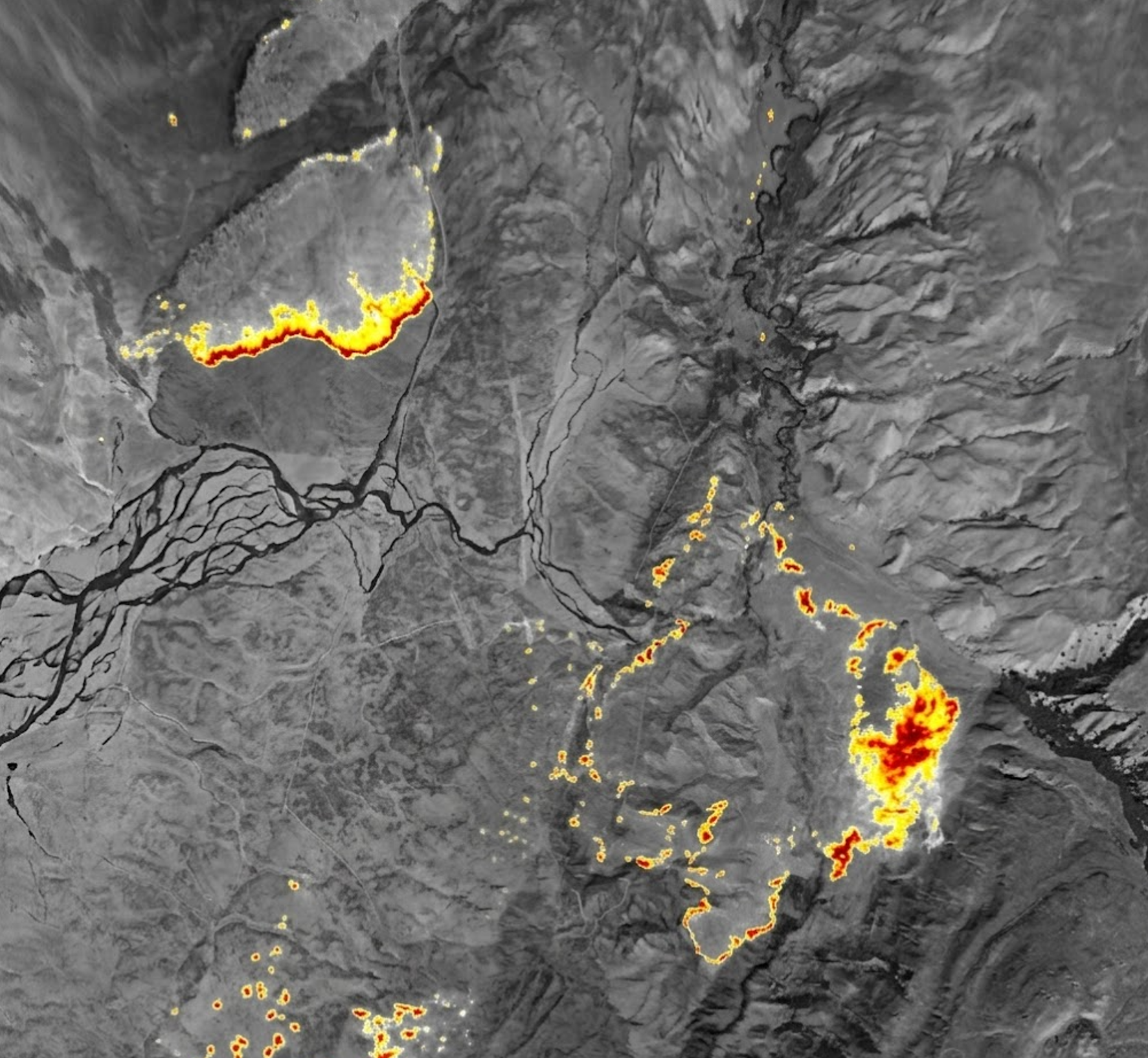
// 3 IR / RGB / NIR
All in One (AiO)
Multiple perspectives. One complete picture.
Thermal, color and near-infrared imaging in one orbit-ready system. Fire intelligence before, during and after an incident.
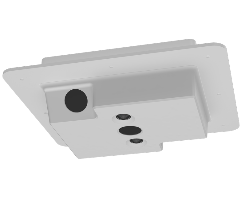
// AiO · S006-640-R01
Five sensors. One mission-ready system.
Three radiometric LWIR cameras pair with 3.2 MP RGB and NIR sensors across a combined 150° horizontal field of view. Integrated GPS/INS, onboard multi-day storage and native cloud offload connect aerial imagery to geolocated intelligence — without operator input or special flight paths.
$82,850/Custom variants available
// Capabilities
Intelligence in the air. And beyond.
Thermal + RGB + NIR
Three 640 × 512 LWIR cameras capture thermal information, while RGB and 850 nm NIR sensors add complementary views of the landscape.
Geolocated video and snapshots
Integrated GPS/INS supports georeferenced imagery, H.264 video with MISB KLV metadata, and full-resolution stills for GIS applications.
Orbit-ready passive mapping
Wide-field optics collect fire imagery without special flight paths or operator input. Onboard storage and cloud offload connect collection to incident-wide awareness.
// Specifications / S006-640-R01
Integrated imaging. Serious capability.
- LWIR cameras
- 3 × 640 × 512 / 12 µm
- RGB sensor
- 3.2 MP
- NIR sensor
- 3.2 MP / 850 nm
- Radiometric accuracy
- ±10°C at operating altitude
- GSD at 2,500 ft
- IR 1.3 m / RGB & NIR 0.95 m
- Combined horizontal field of view
- 150°
- Dimensions (L × W × H)
- 8.1 × 7 × 2.3 in
- Weight
- 1.1 kg / 2.4 lb
- Power
- Up to 30 W / 28 V DC
- Connection
- 1 Gbps Ethernet
- Positioning
- Integrated GPS/INS; L1 multi-constellation GPS or digital input
- Mounting
- Flange with #8 through-holes
- Storage
- Onboard multi-day storage
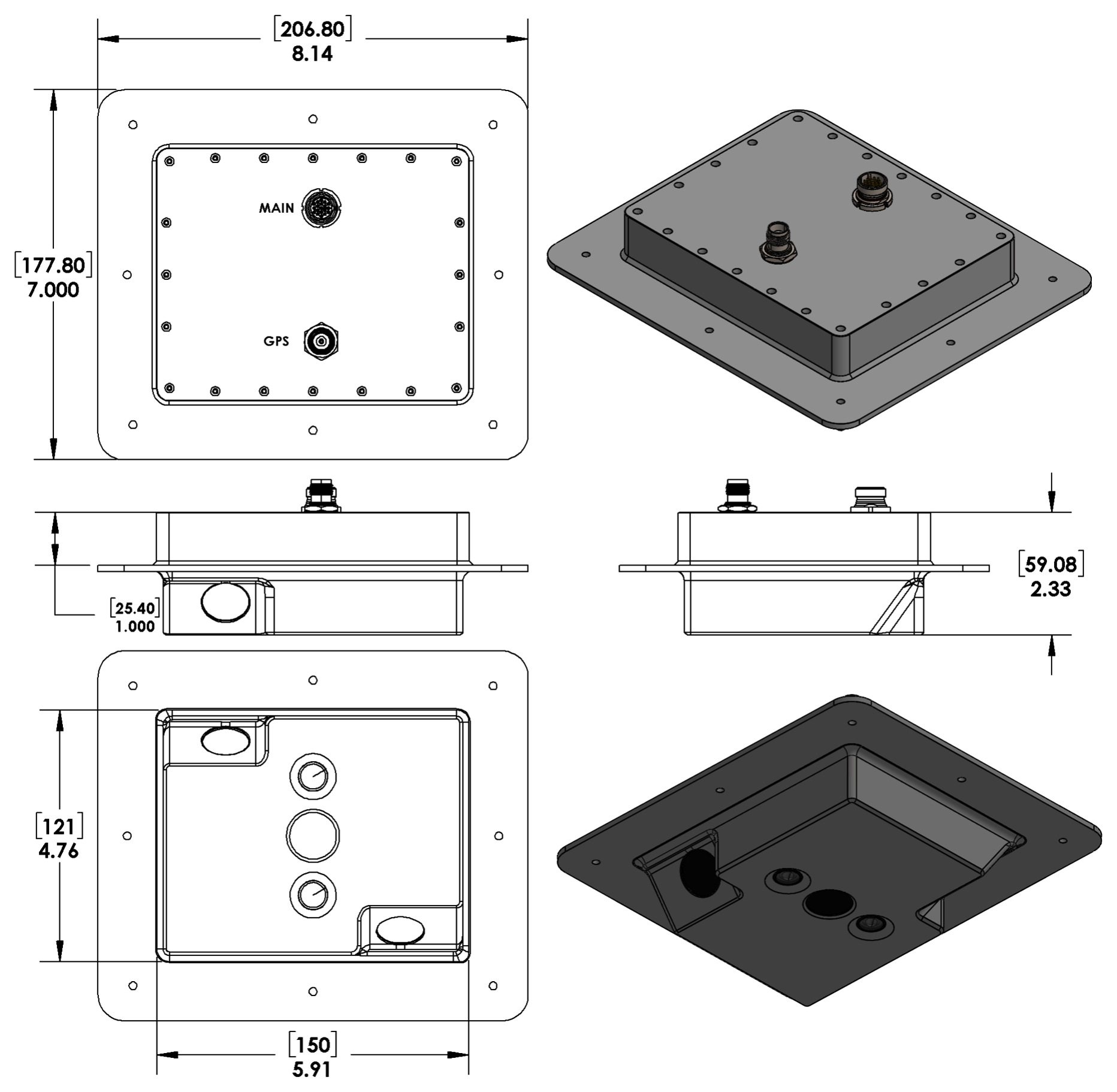
Preliminary specifications — subject to change. October 2026.
// Purchase & seasonal leases
Choose your configuration.
| Configuration | Size (L × W × H) | Weight | Purchase | 3-month lease | 6-month lease |
|---|---|---|---|---|---|
| S006-640-R01 · 3 IR / RGB / NIR | 8.1 × 7 × 2.3 in | 1.1 kg / 2.4 lb | $82,850 | Request quote | Request quote |
Contact us for custom variants and to discuss seasonal lease options. Lease pricing and terms are not listed in the AiO datasheet. Specifications and pricing are subject to change.
Discuss your configuration// Hardware outputs
Ready to connect.
- H.264 MISB KLV digital video
MISB ST 0601 metadata over Ethernet for geolocated video applications
- Full-resolution geo-snapshots
Georeferenced stills for GIS applications
- Radiometric infrared imagery
Thermal imagery with temperature information from three LWIR cameras
// Software / Cloud outputs
Ready to share.
- Orthorectified image mosaics with IR hotspots
- Orthorectified RGB and NIR image mosaics
- Active-fire perimeters in .SHP and .KML formats
- Full- and low-resolution geo-snapshots
- H.264 streaming video
- Compatibility with leading GIS and fire common operating picture software
No ongoing software license is required for direct viewing. Cloud processing and sharing depend on connectivity and the selected platform. Cloud providers and GIS software may incur usage charges.
// Product documentation
All in One (AiO) datasheet
Original AiO specifications, configuration and outputs · PDF · 2 pages